
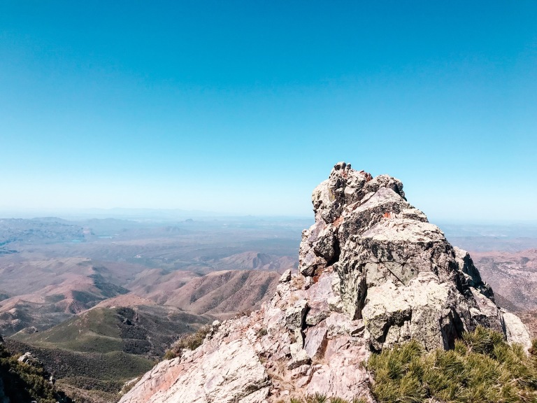
Four Peaks is an icon in the skyline looking East from Phoenix. Although it towers over the desert, the mountain itself is covered in foliage. It climbs over 3,000 ft above the Valley floor to an elevation of 7,659 ft. The top is covered with pine trees, and the occasional snowcap in the winter. That makes this spot a welcome respite from the heat in the summer.
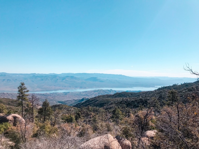
Although the conventional way to reach the top of Four Peaks is from the southwest, the quicker drive may be from the northeast. We have tried both routes and personally prefer this route from Roosevelt Lake. You’ll drive more freeway miles and fewer dirt road miles than Four Peaks Road. (It’s also less washboard-y and kinder on your vehicle!) You’ll also be rewarded with epic views of Theodore Roosevelt Lake and the Four Peaks wilderness along the way.
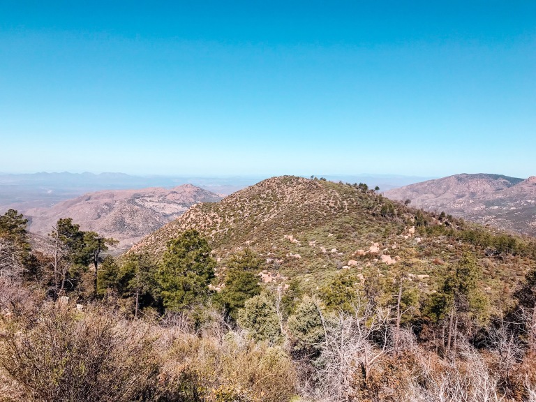
Take a quick drive on El Oso Road towards Four Peaks:
How to get there:
↠ Take the Beeline Highway 87 Northeast out of the valley, towards Payson. Stay on this for about an hour. Just before the town of Rye, turn right onto AZ Route 188 South, heading Southeast towards Theodore Roosevelt Lake. Drive through the town of Punkin Center. Just before you reach the lake, turn right onto El Oso Road.
Gilbert to El Oso Road: 1 hour 45 minutes
Glendale to El Oso Road: 2 hrs
↠ The road turns to dirt pretty quickly. Now it’s time to go slow and enjoy the views! You can pull over and take photos wherever. Take this road to the top of the saddle, then decide if you go explore and snap a few more photos and/or hike around a bit. To get to the trailhead, turn South onto Pigeon Spring Road and follow it until it’s end.
Beginning of El Oso Road to Brown’s Peak saddle: 30 minutes (without stopping)
About the drive:
↠ Gas: Gas up before you go! Your options after you leave the Valley are: near the beginning of our drive in Fountain Hills, 1 gas station called Jake’s Corner General Store (on the 188 shortly after you exit the highway), or past the exit for the 188 into Payson.
↠ Restrooms: The closest restrooms to El Oso Road are at the day use areas lining Roosevelt Lake, or in the town of Punkin Center.
↠ Bring: Always bring drinking water (and snacks!) for the road. If you plan to hike or explore around a day use area, be sure to bring appropriate footwear and sunscreen.
↠ Check: Check current traffic conditions on the way there and the way back- occasional closures happen with sections of the Beeline Highway.

About El Oso Road:
↠ Restrooms: no (closest- Roosevelt Lake)
↠ Drinking water: no (closest- Roosevelt Lake)
↠ Picnic tables: no (closest- Roosevelt Lake)
↠ Grills: no (closest- Roosevelt Lake)
↠ Season: Best in February-November. A portion of the road (and therefore, your access to the top and trails) may be closed in the winter if there’s a lot of snow. Be very cautious if you proceed and there is snow or ice on the ground.
↠ Dispersed camping: Yes, there are several small dirt areas along El Oso Road (*Note: Always research campfire bans ahead of time, and follow Forest Service signage.)
Remember:


Thanks for taking look at our drive up El Oso Road! We hope it was helpful for you in planning your own trip to the top of Four Peaks. Comment below or send us an email at wildthingsandcoffee@gmail.com if you have any questions, or if you want to tell us what you did with our advice! We’d love to hear from you 🙂
Click HERE to see our other recent blog posts and click HERE to see a list of ALL of our free travel and hiking guides!
